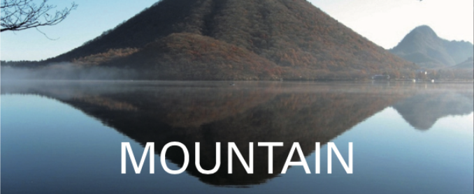

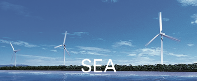

This museum introduces the geography and history of Iso Hikamicho, which has a central watershed on Honshu Island. The flow of water divides the Seto Inland Sea and the Sea of Japan at Iso Hikamicho, which is the lowest point in Japan, at an altitude of 100m.
This museum exhibits a model of the topography of the watershed and a full-scale model of Takasebune, a flatboat, that conveys the history of the Kakogawa River boat transportation. This museum introduces the fem (pteridophyte) of a southern species that lived north of the border and Minamitoyomi, pungitius kaibarae, the extinct north-stream fish that appeared south of the border.
This park helps you feel and think about water. The backbone range runs through the Japanese archipelago and rain branches into the Seto Inland Sea in the south and the Sea of Japan in the north at the central watershed. This park is at the foot of Mt. Kiyomizuyama, with an attitude of about 100m at Hikamicho Tanba City, which is the lowest, easternmost point of the central watershed of Honshu Island.
The climate, flora and fauna change beyond the watershed border, but those distinctions are vague at the border. There are colonies of dogtooth violet in a cold district. There are realities of nature that exceed the common sense of science.
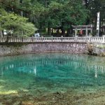
The pond is a transparent blue, unique to the karst landform, which is the mystery of the earth connecting to the deep sea. It was said that there was a rich person suffering from a water shortage. After cultivating the land, he followed the oracle in his dream and enshrined Benzaiten: Sarasvati, the god of wealth, music eloquence and water, at this pond and water sprang up.
The coral reefs in the south sea were carried to the north 350 million years ago, raised, and becoming Akiyoshidai, karst plateau. The long voyage from the south sea is told by fossils such as corals and sea lilies in limestone.
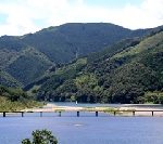
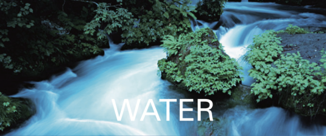
The Shinamtogawa River is the last clear stream in Japan. It meanders through the Midwestern part of Kochi Prefecture to the Pacific Ocean. Classes for touring the river, along the 8km stretch between Ekawasaki and Iwama, are held at the Kanoue House of Shinamtogawa River Michinoeki. There, you can enjoy the nature of the Shinamtogawa River.
The Shimanto tectonic zone is the crustal structure, and the base of Shikoku Island, which has traveled with the Kuroshio, the Japan Current, from the southern seabed more than 100 million years ago. Ancient memories remain in nature.
While going down the Watarigawa River (the Shimantogawa River‘s previous name), you can feel the eternal time.
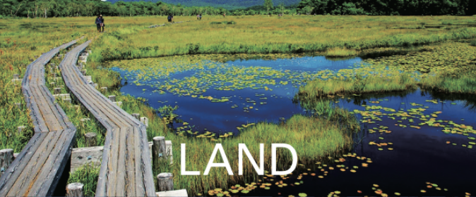
You can see the views of the lush mountain greenery and the tranquil rural scenery at the foot of the mountain in Miyawaka City, which used to be the domain of Munakata Taisha Shrine, since the Taika Reforms in 645, political innovations led by Prince Nakanoue (Emperor Tenji) (626 – 672), and Furiwara Kamatari (614 – 669), against the powerful Soga clan, to extend the direct dominion of the Emperor’s family over the whole of Japan. It is a beautiful green village, due to the graceful water from the mountains.
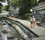
Rakusuinomichi Promenade is a 500m promenade that uses natural stones along the Inunakigawa River, between the Zasunosebashi Bridge and the Wakitabashi Bridge in Wakita Onsen, hot spring. The refreshing breeze and the quiet murmuring of the stream makes you feel at ease.
Mt. Gozendake, located on the prefectural border between Yame Fukuoka, and Hita Oita, is an ancient sacred mountain, which is associated with Kumaso, a tribe living in the ancient Kyushu district. The tribe was seized by Emperor Keiko, the son of Prince Yamato Takeru, in his conquest of local tribes in Japan. Japan General Guardian of Oyamatsumi no mikoto: a god of mountains, sea and war in Japanese mythology. Mt. Gozendake is famous as the virgin forest of Shioji, ash, too.
You can find many springs coming from Mt. Gozendake within a 30 minute walk from the start of the mountain trail. The water has an abundance of minerals and is one of Oita Prefecture’s most famous waters, along with Oike pond in Yufu City.
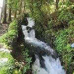
This Gorge is located in the upper reaches of the Kuwabaru River. It is a clear stream from Mt. Natsukiyama of the Sobo-Katamuki Mountain Range, which rises at the prefectural border of Oita and Miyazaki.
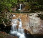
Various potholes carved, such as bunodont, spiral and gourd-shaped follow for 8km distance from the water source of Kanondaki Water Fall to Fujikawachi village.
The Kanoundaki Water Fall is a big waterfall in 77m high and 2m wide. The red granite wall of the water fall shines in the sunset, and the frozen wall in the winter reflects the morning sun.
Miyakonojo City is a basin surrounded by the Kirishima Mountains to the west and the Wanitsuka Mountains to the east. At the end of the season, a mountain fog arrives in the basin and a magnificent sea of clouds appears from Mt. Kanemidake.
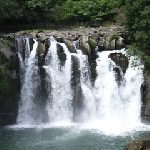
Sekinoo Falls, is one of Japan’s Top 100 Waterfalls, which was formed by the collapse of a river that eroded the welded tuff created by a large eruption about 330,000 years ago. The splash that rises with the roar is just the rare energy that throbs now.
There are two mysterious streams in a national park taken hold by Mt. Kirishima. From November to April, the Mitaaraigawa River is mostly dry, and starts to spring out water around May, and the Ryodogawa River starts to spring out water in June. It becomes dry around August and September. Both rivers are extremely clean and abundant.
The mysterious streams have been loved as a reservoir of nature, and the water source is gracefully changing deep underground in Mt. Kirishima.