


The Saitama group of ancient mound tombs consists of eight large keyhole-shaped mounds and one large circular mound.
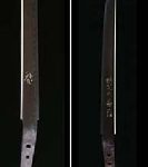
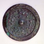
The Inariyama shrine, built before the tombs, has contains a national treasure gold damascening Sword “Kinsakumei Tekken”, inlaid with 115 letters, stating“ I am the 8th descendent of Owake Shin and I served as the captain of the Guard for the Yuryaku Emperor” were inlayed.
This national treasure symbolizes the influence of the Yamato sovereignty in the latter part of the 5 Century. This museum exhibits this national treasure in a case filled with nitrogen gas.
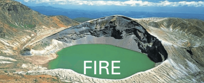
“Discover this 10,000 year old sacred place!” -This museum neighboring the sacred area of Hikawa Shrine, is in the Omiya Plateau. Lakes and marshes around here were good locations for the development of rice paddies and for managing irrigation in ancient Japan. The relics show the ancient, rich nation state in Saitama.
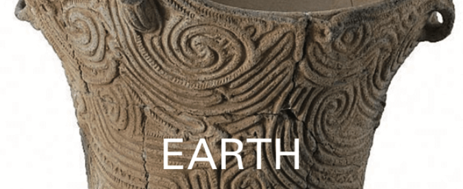
The area where the Jomon and Yayoi culture spread over 10,000 years ago, was the center of Keno Province in the Tumulus period (the 3rd– 7th century), and the center of Musashi Province in the Nara period (710 – 794). In the Medieval ages, the Musashi samurai group appeared here and developed up the hillock of North Musashi.
This museum introduces the history of Saitama, which was the development of the Five Kaido Road from Edo (Tokyo) in the early modern times. It overlaps with the history of Musashi samurai group of North Musashi.
The museum’s collection includes the National treasure, a sword from the Kamakura period (1185 – 1333), and the folding screen drawing of the Battles of Genji clan and the Heike (Taira) clan in the the Edo period (1603 – 1868).
The area of the hill in the description of Nasu Fudoki, the Japanese regional climate, culture, and others, is located at the junction of the Nakagawa River and the Hokigawa River, in the northeastern part of Tochigi Prefecture, where are many big tombs. The government office and agency was here, during the Nara period (710 – 794). Nasu was the base for the Mutsu Province, where Tosan-do Road, an ancient division of the country and the main road running through it, was situated along the central mountains of northern Honshu.
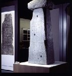
This museum introduces the construction and discovery of the inscription of Kuni no Miyatsuko, the regional administrator of the Nasu Province, which was made of granite and has a 152-character inscription honoring the achievements of Natsu Kuni no Miyatsuko. It helps us trace the establishment of Nasu Province by the Yamato Kingdom.
The area of the hill of Nasu Fudoki, a description of Japanese regional climate, culture, and others, is located in the northeastern part of the prefecture, near where the Nakagawa River and the Hokigawa River meet. There are many large-scale tumuluses remains. Nasu used to be an important base toward Mutsu Province, Tohoku region, where there was a government office and agency and Tosan-do Road, situated along the central mountains of northern Honshu, Tohoku region, passed through, in the Nara period (710 – 794).
This museum introduces the transition of ancient Nasu culture. It is said that powerful families built tumuluses in Nasu, had strengthened their ties with Yamato Kingdom, from the 4th – to 7th centuries, and formed the coalition of powerful families.